


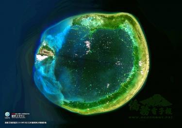
Formosat-5, the nation’s first domestically developed remote-sensing satellite, has garnered commercial revenue of more than NT$4 million (US$128,804) after operating for nearly a year, the National Space Organization (NSPO) said on Friday.
The satellite was launched by SpaceX’s Falcon 9 from the Vandenberg Air Force Base in California on Aug. 25, 2017, and began commercial operations on Sept. 21 last year.
As of last month, sales and service charges garnered through its satellite images have exceeded NT$4 million and are expected to reach NT$10 million by the end of this year, the NSPO said.
The organization has contracted US firm Apollo Mapping Co to sell images from the satellite, while an Australian company is expected to join soon, the NSPO said, adding that it is also negotiating with a British firm.
In addition to commercial sales, the satellite’s images are open to domestic researchers and firms for free use through a Ministry of Science and Technology platform, which relays data for land planning, environmental monitoring and disaster evaluation, it said.
For example, National Chung Hsing University has used Formosat-5 images for research on the Laonong River basin in Kaohsiung’s Taoyuan District; Chang Jung Christian University used its images to study winding rivers and gravel in mountainous areas; and Providence University used them to examine the distribution of alien plant species along central Taiwan’s coasts, it said.
As of the end of July, images collected by Formosat-5 have been viewed 12,749 times with nearly 5,000 downloads, it said.
Many foreign institutions used its images for land planning or disaster prevention purposes, including in Nicaragua and Indonesia, while the NSPO has shared images with other countries through the Japan-led Sentinel Asia platform, it said.
After a magnitude 6.7 earthquake in Hokkaido, Japan, in September last year, the NSPO offered the images to the Japan Aerospace Exploration Agency to monitor landslides, it said.
While Formosat-5 does not have the capacity to produce hyperspectral images, they still offer information that the agriculture sector can use to make decisions, the NSPO said, adding that it would increase its assistance in the domain.